LAWHAR SBIR
A cloud-based tool suite providing guidance on low-altitude weather impacts on UAM, UAS, and Helicopter/General Aviation operations and infrastructure.
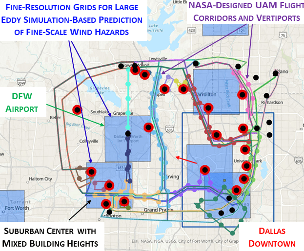
Current operational weather guidance does not provide the spatial and temporal granularity necessary to support key decisions related to Urban Air Mobility (UAM), Unmanned Aerial Systems (UAS), and Helicopter/General Aviation (GA) operations and infrastructure. Key decisions affected by this limited guidance include Vertiport Siting, UAM/UAS Flight Corridor Design, Wind-Sensitive Dynamic Flight Routing, and Wind Hazard Alerting. Turbulence and eddy effects created by winds flowing through urban canyons cannot be predicted using current weather guidance, threatening the economic viability and scalability of UAM/UAS/Helicopter/GA operations.
ATAC’s suite of fine-scale, low-altitude urban airspace wind prediction and wind-impact translation tools, called the Low Altitude Wind Hazard Alerting and Rerouting (LAWHAR) service, leverages state-of-the-art Graphical Processing Unit (GPU)-accelerated Large Eddy Simulation (LES) models to predict building-induced wind effects in urban canopies at fine resolutions. LAWHAR translates these fine-scale wind effects into UAM operational impacts by applying innovative data-mining-based clustering to LES outputs for predicting dynamic wind-hazard regions.